On our last trip to Virginia Amy and I had an extra day, so we went with her folks and sister to Appomattox Court House. I don't think I'd ever been there, but I'd heard about it quite a bit as I've enjoyed studying the history of the Civil War for many years.
If you don't recognize the name then you should know that this is where General Lee surrendered the Confederate Army of Northern Virginia to General Grant. The most interesting thing I learned was where the village got its name. County seats in Virginia were always named Court House. The town of Clover Hill became Appomattox Court House in 1845 when Appomattox County was created.
Appomattox Court House National Historical Park is located in south central Virginia, 92 miles west of Richmond and 18 miles east of Lynchburg. It is on Va. 24, three miles northeast of the town of Appomattox, where motel accommodations, restaurants, and stores are located.... Park programs show how the war affected the people of the village and how they lived from day to day.
--from Appomattox Court House NPS brochure

You'll see a picture later, but the village of Appomattox Court House was located on the Richmond-Lynchburg stage road. Part of that route is now a local highway. I think it is interesting, but makes quite a bit of sense, how road routes and buildings get reused over the years. One of the reasons that Appomattox Court House has been preserved is that the town itself moved south. Starting in the 50s (the 1850s that is) the population really started to move towards Appomattox Station three miles away because that is where the railroad line was built. Additionally several buildings in the town were rebuilt when the National Park Service took over in the 40s.
 After the surrender ceremony the troops went away and the war ended, but Appomattox Court House had been changed. In many ways the village was worse off. No large battle had taken place here; neither side rushed in to erect monuments as they did on many other battlefields of the war.... In the late 1880s Union veterans formed the Appomattox Land Company. They hoped to develop the area by selling lots and building houses, but their plans never really left the drawing board. In 1892 the courthouse burned...and the county seat was moved to Appomattox, formerly Appomattox Station. And in an early 1893 a Niagara Falls, N.Y., company had the McLean House dismantled with the hope of taking it to Washington, D.C., as a war museum. But the piles of bricks and lumber were never moved. exposed to the elements, they eventually disappeared. The little village was either going up in smoke or crumbling into dust.
In 1930, Congress passed a bill that provided for building a monument at the site of the old courthouse. The monument was never built, but the idea of memorializing the event stayed alive....
Legislation creating the park as a national historical monument was signed in 1935, and work began on acquiring land and researching the records. The project resumed at the end of World War II; in 1954, the area was redesignated Appomattox Court House National Historical Park. Today the village looks much as it did in April 1865.
--from Appomattox Court House NPS brochure
Before we drove to the park I discovered the podcasts available on the
Civil War Traveler website. Most of the podcasts were developed in association with the National Park Service and you can find downloads for many sites throughout the South. You can listen to the Appomattox audio
here. I downloaded it to my iPhone so I could listen to it on-site. Once we arrived and I started picking up brochures (yes I'm one of those people) I discovered that they also had a cell phone audio tour. If you'd like to listen to some of it you can call 434-352-6027. There are nine sites including four in the old village that I listened to. We didn't tour the entire area so there were some parts of the site that we skipped. Of course that just gives me a reason to go back in the future, ;-).
Since the original courthouse burned down at the end of the century--no, not the last one, the previous one--the building had to be completely rebuilt. It now incorporates restrooms, a theater, and a number of exhibits (as well as offices I'm sure). I imagine that only the exterior is the same as the original building. It still is a very nice looking building.
Inside I was immediately drawn to the map of the park. I suppose things like that are fairly easy to make in a park where you know the names won't change. I can't imagine something that permanent in my job because things change all the time.
There wasn't too much going on downstairs, but there were a couple brochures and some donation boxes. The donations were tracked by state and unsurprisingly Virginia was at the top--but California was #3!
I really enjoyed a small sign that told what happened during the war on the day you visit.
Upstairs though there some good exhibits and I spent a few minutes looking around. One display that was nice was likely older, but I think it holds up well against more modern equipment. This display would still be valuable if the interactive portion were inoperable. Here you can see a short segment of the display as the narrator talks about the Confederate retreat towards Appomattox as Grant's forces cut off Lee's intended movement towards North Carolina (where he could have joined up with other Confederate forces).
After watching this my in-laws let me know that the theater was ready to play, so I headed that way with Amy. The room was interesting as it had obviously been built with a projector in mind (there was a projector room in the back above the entrance) but the screen had been replaced by a large screen TV that appeared to be playing a DVD. There were a good number of artifacts on display, including several pieces used by individua soldiers.
The most memorable was the surrender table, which had obviously been preserved many years earlier as it was stamped with the fact that it was the table in question, whereas a modern preservation effort would leave it in original condition if at all possible.
And lest you think that only modern people are obsessed with souvenirs then you should read about the "apple tree myth" at Appomattox.
The story got around that Lee and Grant had met under an apple tree to discuss the surrender. After the conclusion of the event soldiers descended on the orchard and demolished its trees on the hunt for souvenirs.

Did you realize that the popular "Confederate flag" that you see was actually the flag of the Army of Northern Virginia (Lee's Army) and was not the Confederate national flag?
The flag hanging in the picture at left was actually the third national flag adopted in early 1865, just shortly before the end of the war. The previous version was virtually identical, but there was no red bar across the white portion of the flag.
Once we were finished looking around at the visitor center exhibits we headed outside. I split apart from others and listened to the podcast that I'd downloaded. First I headed over to the McLean house (where the surrender documents were signed) then to the Clover Hill Tavern and finally to the review area where the surrendering Confederates marched past Union soldiers. I didn't go inside many of the buildings though, as I was waiting for everyone else before I looked at any of those sites in detail. There was a living history presentation on the front porch of the tavern. Next time we visit I want to listen to (and perhaps record) one of these talks. I really enjoy things like this (Colonial Williamsburg for example is amazing!).
I walked past the jails, both the ruins of the old jail on the left and the new jail on the right--I forgot to go inside the new jail, though my sister-in-law texted me a picture of Amy behind bars.
The next place I came to was the Jones Law Office. According to the NPS brochure this original building was the "[o]ffice and town home of Crawford Jones, Appomattox County farmer, lawyer, and local secessionist leader." There wasn't very much signage around the building, but I could walk in the door, stand behind a railing, and look around. I really enjoy the fact that while some buildings had to be reconstructed there were buildings like this that have survived the many years.
The walls of the building appeared to be fitted together rather well.
Framing shots can be quite fun.
Several signs are located in front of the Peers House, and a canon rests on the lawn.
George Peers, clerk of the Appomattox County court for 40 years, lived in this frame house, which was built in the early 1850s. Not open to the public. (Original)--from Appomattox Court House NPS brochure
Stacking of ArmsOn the morning of April 12, 1865, about 5,000 Federal troops lined the Richmond-Lynchburg Stage Road from just east of the Peers House to a point near the McLean House to receive the surrender of the Army of Northern Virginia. The weapons, flags, and accoutrements of Lee's infantry were stacked before the Federals in a formal surrender ceremony that Brig. Gen. Joshua L. Chamberlain dubbed "Honor answering honor."--from Appomattox Court House NPS brochure
I spotted a few of the modern support staff before I saw several signs sitting together at the end of a path.
One of these signs described one of the meetings between Generals Grant and Lee.
But the other one covers the ceremony at the end of the proceedings (described in the quote above):
Better than that was an interactive display--well a button that when pressed triggered an audio recording about the ceremony. Of course I had to take a video.
After this I walked back to meet everyone else. We spent some time in the bookstore (located in the tavern kitchen building). I picked up some postcards, a book, and my mother-in-law bought me a shirt. After this we went through the tavern. We entered and left via the back door since a program was being conducted on the front porch (see the video above). This building was where all of the Confederate paroles were printed.
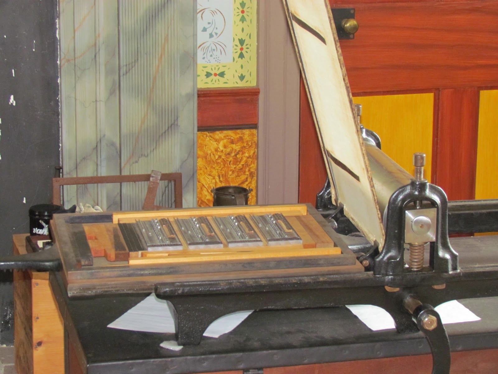
The surrender terms were quite generous, as befitting the start of the reconciliation process at the end of the war. Soldiers were allowed to return home. The printed paroles identified them as a surrendered soldier (instead of a deserter), allowed them free transport on railroads and ships controlled by the Federal Government, and allowed them to receive needed supplies from government depots as well. Several portable presses were brought in to quickly print the thousands of paroles that were needed in rather short order.
The other half of the building featured a display that included several parole examples.
Across the way an attorney's office was fairly normal, but one of the candles inside was rather amusing. It obviously hadn't reacted to the heat very well.
The next place we explored was the Meeks Store (which also served as the post office). The building is original and was constructed in 1852. One half of the building had a door which closed by a spring and the reason was obvious once I entered--there was an air conditioning unit operating.
Lafayette Meeks is buried in a field behind the store. At first I just took a picture from a distance, then I realized that we could cross the fence and go closer to the grave. So Amy and I headed that direction.
When we got to the grave we noticed a small stone at the far end of the grave area, directly next to the fence. We later discovered that it was a footstone, used to mark that end of the grave. I don't remember if I've ever heard of those before, but I thought it was quite interesting. The headstone is remarkable as far as how legible it is, even with several cracks going right through the stone. Lafayette died during the war, but on another battlefield, and his body was brought home to be buried.
The last building we visited was the McLean house, where the actual surrender took place. One of the things you learn there was something I already knew. When the war started McLean was actually living in the northern part of Virginia, right near Manassas (where the Battle of Bull Run, or First Manassas took place). He reportedly moved to Appomattox to get away from the war, something that worked quite well until what was very close to the end of the war fell on his doorstep.
A rather vocal (but quite informative) ranger waited inside the McLean house. One of the first things I saw was a map detailing what happened after Appomattox.
One of the most interesting things I noted was the CSS Shenandoah. The ship was a Confederate commerce raider built in England. The crew kept attacking ships after the end of the war because they didn't know that all other Confederate forces had surrendered. Finally they captured a ship whose captain told them that the war was over. If I remember correctly (what I've read and what the ranger said) they didn't believe the news until they got it from a British source. At that point they sailed to England, turned the ship over to British authorities, and fled. They had letters of marque, but were afraid of being called pirates by the North.
The McLean house was reconstructed, but the center portion of the front wall consists of reclaimed original bricks. Inside I'm not certain how much furniture is original, but I assume that at least some of it is, if not a bit more.
I have to admit that one of the things I enjoyed was the fake food used to decorate the tables in the house and the kitchen.
There were a couple more rooms upstairs.
Behind the house was the kitchen, constructed as a separate building, not only to separate the slaves from the main house, but to keep the heat of cooking outside also.
There was also a cradle in the back room of the kitchen building that contained a rather interesting pillow. From what Amy remembers it looks as though the pillow is indeed an original artifact.
The slave quarters were in yet another, simpler building.
Finally I looked in the outhouse, but sadly it wasn't real (or at least there was no actual pit).
~Matt
PS All of the above pictures, and actually quite a few more that I didn't take time to write about (or perhaps forgot about) are in the complete album which plays as a slideshow below. I hope that you'll take a couple minutes to check it out. Feel free (i.e. please do) leave any pertinent comments on this post, or even on the pictures if any of them are particularly interesting to you. Thanks!