Thursday, July 12, 2012

National Expansion

On the first day of our big summer trip (yes, I'm blogging about it at long last) we drove to Kansas.  We actually got to be in quite a few states that day.  We started in Kentucky, drove through Ohio for a bit (thanks I-275), Indiana, Illinois, Missouri, and then Kansas.  While in St. Louis we decided to stop at the Jefferson Expansion National Memorial down by the river.  Like many things this trip the Arch was something I hadn't seen in many years, since I was a kid.  The trip was one of rediscovery for me and of showing things I knew to Amy.  :-)

Besides stopping to see the arch (and the museum underneath it) I wanted to buy an annual parks pass.  I'd been looking ahead and knew that we would need to pay $25 to enter Yellowstone.  I also noticed that there would be plenty of NPS sites along our route, and while some were free a fair number did have entrance fees.  Therefore I figured it would be worth it to spend $80 and get an America the Beautiful Annual Pass.  The pass covers Amy and I (or the whole car we're in if fees are charged by the carload):
This pass is available to the general public and provides access to, and use of, Federal recreation sites that charge an Entrance Fee or a Standard Amenity Fee. The card is good for one year, beginning with the date of sale. The cost is $80.00. The pass admits holders and passengers in a non-commercial vehicle at "per vehicle" fee areas. It also allows the pass holder, plus three adults (not to exceed four adults), at "per person" fee areas. Children under the age of 16 years are admitted free.
It was a great deal and I'm determined to get our money's worth by visiting as many sites as we reasonably can.  We bought the pass on June 1, so it is good for 13 months--expiring at the end of June, 2013.  So if you're keeping up on my summer blog posts expect a fair number of them to be about National Park Service sites.


Once we'd parked at the arch we walked through a beautiful grove of trees towards the base of the arch and the museum and visitor center buried beneath it. I'd looked ahead and knew that security was tight:
Security Note:
Due to security measures at the Gateway Arch, all visitors to the Arch must pass through a security checkpoint. No weapons--including knives--are allowed. If you have pre-purchased your tram ticket, please arrive at least 30 minutes before your tram time.
It was quicker than TSA checkpoints though, so that was something to be thankful for.  I didn't think they'd appreciate a picture of the checkpoint however, so I refrained.  The arch has been around a while and I had to get a picture of the dedication plaque on display right by the entrance.


Once inside we looked around for a bit and I ended up getting my pass.  By the way, if you are over age 62 you need to buy the Senior Pass.  It is only $10 and it is a lifetime pass that will get you into National Park Service and other "Federal recreation sites that charge an Entrance Fee or Standard Amenity Fee."  Trust me, you want it, ;-).  I know that my parents have one and they've used it.


There was a ticketing area, but we didn't visit it.  The Museum is free, the tickets are just for the car up to the top of the arch. I want to go up again sometime, but this was not the trip for that.


I did really enjoy the first display that we saw telling the history of the arch via a bas relief panel.  Sadly I only have one picture of the display.  However, it did compare the height of many other memorials and structures--showing that the arch is quite tall.


The Museum of Westward Expansion is laid out in a slightly confusing manner--you really have to pay attention to realize where the timeline progresses.  We didn't want to spend too much time looking around (as we still needed to drive beyond Kansas City) so I only took a few pictures at first.  As I mentioned, much of the museum was laid out around the concept of a timeline of the nineteenth century, part of which you can experience on the NPS website.

1800:
The U.S. Capitol is moved from Philadelphia, and Congress convenes in Washington D.C. for the first time. By secret treaty, Spain cedes the Louisiana Territory to France. Second census: U.S. Population- 5,309,000.
1801:
Thomas Jefferson is inaugurated as the third President of the United States in the first Presidential inauguration to be held in Washington, D.C. Johnny Appleseed (real name John Chapman) arrives at Licking County, Ohio with a bag of apple seeds. 
1802:
The "right of deposit" for Americans is withdrawn by the Spanish in New Orleans. American pioneers west of the Appalachians are greatly alarmed by this move, since New Orleans is the only port through which they can sell their products profitably. The move prompts President Jefferson to begin negotiations for the purchase of New Orleans, which culminate in the Louisiana Purchase. 
1803:
France sells Louisiana to the United States for $15,000,000. This first territorial expansion of the U.S. west of the Mississippi totals 828,000 square miles. Army officers Meriwether Lewis and William Clark are chosen by President Jefferson to lead an expedition from St. Louis to the Pacific Ocean, for the purpose of discovering a direct water route across the continent and to keep records of the natural resources of the new land, with the aim of establishing an American presence in the northwest through trade and settlement. 


As much as I like signs there were simply too many to take pictures of during the limited time that we had available, so the large displays caught my attention and that of my cameras.

I did see a sign a couple times that I thought was quite good (if it was read by guests).  It mentions that only live animals can regrow hair--so if you touch a stuffed animal and cause its hair or fur to wear off it can't be replaced!

I found a large exhibit on Indian peace medals to be quite interesting.  Apparently they were traded and then manufactured as tourist items fairly early on in the 1800s.  There was even an animatronic of an engraver from the mint.

The British made the first medals to be used, which isn't surprising, especially in light of the tribes that later allied with the British during the American Revolution.
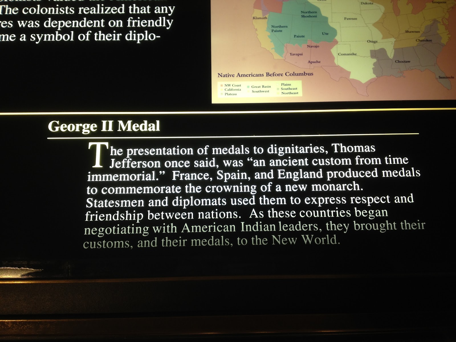

The Jefferson medal was apparently a model for future medals.  It is one of the designs that recently appeared on the nickle redesign, and I got a smashed penny with the design also.


We also enjoyed spending some time in the shops.  I of course had to buy a few postcards (including some duplicates for mailing to people).  The themed shop was the most fun with products and displays that looked to be straight out of the 1800s.

Amy even found a book that she thought was pretty cool, though we didn't end up buying it.  Okay, I should mention that Amy remembers the Oregon Trail computer games and is convinced that just about everyone died on the trail, ;-), so a book entitled "the tragic tale" about the Oregon Trail seemed to be quite appropriate to her.

So someday we'll definitely be back to the Gateway Arch.  And next time we'll take the ride to the top and I'll take plenty of pictures from up there.

~Matt

Monday, June 04, 2012

Passport to Adventure


I've had several National Parks passport books over the years. I still have my first one, but unfortunately I didn't have it with my one time at a park and I ended up buying another one. That one was only used once and was then left at home (I don't have a stamp from the Statue of Liberty and Ellis Island though I did visit them). My third (and hopefully final) book is kept in my car do it is handy.

Whenever I visit a unit of the National Park Service I look for the cancellation station and stamp my passport book. I really enjoy it and it is a great way to track visits. I hope to do this when we have kids someday also.

Recently I discovered a Passport app developed by Eastern National and I downloaded it immediately. It has a couple purposes. I input all of my visits from all three books (thus the above number indicating I've been to 32 parks). It is also helpful in finding where cancellation stations are located in each park.

Lastly I've looked up the parks that are along the remainder of our route and I've marked them as parks to visit. Hopefully we'll be able to visit all nine! Then someday I'll go back to New York City and properly record my visit.

If you visit National Parks frequently or even semi-frequently then check out the passport program. It is quite a bit of fun. I've thoroughly enjoyed it since I was a kid.

~Matt

-- Posted from my iPhone
(c) 2012 iWolff Ltd.

Location:W 3600 S,Perry,United States

Thursday, May 17, 2012

Two Hundred Years in the Making

Last month Amy and I visited Nashville so that we could spend some time with my Grandma before she headed home.  She is now 92 (as of April 1, 2012--yes, she was born on April Fool's Day) but she keeps up to some extent with Facebook, she also texts, and she has a Kindle!  But it is nice to see her in person as well. While we were down there Amy wanted to do some exploring.  She pointed out, correctly, that we usually see someplace new when we visit Richmond, but we hadn't done much traveling on our Nashville trips.  So we decided to go to the Bicentennial Mall in Nashville.

The Mall was created in 1996, during Tennessee's bicentennial celebrations, and is somewhat modeled upon the National Mall in D.C.  It is connected to the capitol building as well as a Farmer's Market.  We started out by parking next to the market and walking through there on our way over to the Mall.

There wasn't too much in the market at that time of year/day, but there were still several interesting things to see (though we some more interesting things later).  I was really excited to see the Mall however.  It had been quite some time since I'd been there and I didn't have any pictures from my last trip (which was when I was a kid visiting the area with my parents).

Along the side of the Mall there is a wall in which are engraved key points from Tennessee history, large pillars on the other side of the side walk mark milestones (mainly ten year increments on the 6's I think).  But more on that later--first we walked over towards the capitol side of the Mall.  Normally there are quite a few fountains there, however they were extremely damaged in the 2010 floods and aren't expected to be operational until August of 2012.

The white "bridge" that you can see in both of these pictures is a railroad bridge that passes through the mall--between the main grassy area and the capitol.  It is nicely decorated and also serves to protect a number of picnic tables as well as a visitors center.  The visitors center looked closed, but we tried the door and it was open, so we went in.  I spied a map up on the wall I started telling Amy and my mom different things about the Civil War and US history  when the ranger said after a bit "I'll just give you my uniform and you can take over."  She then explained that she had focused more on natural history and wasn't an expert on history.  It felt good to know that my historical knowledge was appreciated.

Right next to the visitors center was a map of the mall, so I of course had to take a picture of that.

Right now we're in the middle of the 150th anniversary of the Civil War.  Apparently the visitor center exhibits will be changing to depict different periods of the war throughout the anniversary (i.e. until 2015).


On the far side of the railroad trestle is a massive map of the state of Tennessee.  All of the major cities, roads, rivers, and other prominent features are etched into the stone "to scale, with 12 inches equal to 2½ miles."  It is fun to find different places.  I texted my nephew Townsend a picture of the label for Townsend, TN.  I also took a picture from the perspective of Ocoee (where my sister Laurie now lives) with Amy in the background standing on Nashville (where we were at that moment).  She looks quite far away doesn't she?  As I recall it is a good long drive between Ocoee and Nashville--but no so long as it is between Cincinnati and Richmond, ;-).  Amy's family used to drive across Tennessee when they would travel from Richmond to visit family in Texas.  They would drive from Bristol to Memphis on the interstate (81 I think), so took a video of Amy following the same route on the map:


Above the map are a series of smaller relief maps that explain various portions of Tennessee geography, sociology, and history.  I took pictures of all of them, though I didn't take the time to read all of them.  I was with three people who don't spend quite as much time with historical things as I like to, ;-).


To see all of the signs look at the Picasa/Google+ photo album linked at the bottom of this post.  While we were standing there a train came over the trestle.  I took a video, but it was windy that day so the audio isn't great and there were no train whistles, so you'll have to settle for a picture.  The stone bridge is also part of the trestle, but spans a road.  You can just make out the carved numerals 1776 and 1996 on its towers.
 There was also a circle of Tennessee state flags and I took several pictures as they flapped in the wind until I was happy with one of them.


As we started down the row of historical moments from Tennessee's past I had to take pictures of the signs I saw, ;-).

The first of the historical markers started in the distant "past."
You can read more about these markers in another blog post (rather than making this post extra long).

We came to an amphitheater along our walk and when I stopped to take a picture I also found a sign that talked about what had been in the area before it was designated as the Bicentennial Mall.  Apparently it was extensively used for the playing of baseball during the Civil War and long after.

Because I was taking pictures Amy and I were walking behind my parents.  Normally my dad walks faster than my mom (I also tend to walk faster than Amy), however this day he was walking with her and I managed to take a couple pictures of them walking hand-in-hand.

We also walked through the Centennial Memorial (commemorating Tennessee's celebrations of its 100th anniversary in 1896) and the World War II Memorial, but I decided those two would better be served by two separate blog entries.  At the end of the mall we came to the carillons and the court of the 3 stars.
From this area you could get a great view of the entire Mall with the capitol in the distance.

There are three stars on the Tennessee state flag, representing the three areas of the state I think (perhaps amongst other things).

The area is pretty amazing, especially since things are arranged so that if you stand in the center you hear your voice amplified as if you are speaking into a mic.  I took several videos, but because of the wind you couldn't hear anything of consequence.


We headed back down to the mall and again entered the Farmer's Market area, but at a different point.  There appear to be several different sections of the market including the sheds where we first entered as well as a flea market.  It might be a nice place to go back to during a busier season to see what all there is to see.  Some of the interior reminded me of Findlay Market in Cincinnati.

Before we entered there were some interesting bike racks so we staged a couple pictures.

Amy likes tomatoes, so she got her picture from inside of a tomato.
I think the holes through each slice are for bike locks.  From the side you can see how all of the slices are arranged.

I chose to be photographed amidst the stalks of corn!

Once inside we wandered through a small ethnic food store (most of the areas around the food court were closed for the day).  I found an interesting sign.  It was posted on the outside door of the shop, which was still located inside the main building.


Before we left I had to get one last picture of myself next to a giant ear of corn!


~Matt