Thursday, November 24, 2011

Birth(place) of a Legend

On Monday, on our way down to Tennessee Amy and I got up quite early.  We intended to go to Abraham Lincoln's birthplace, but wanted to be there when it opened so that we couldn't get to Nashville too late in the day.  We did get there shortly after eight, its official opening time.  There were virtually no other guests there, so it was nice to see things and not have to worry about crowds.  One of the employees told us that they were expecting a couple large school groups late in the day.

The grounds were pretty after rain that morning, and I guess the past few days.  Inside we watched a short movie and then walked around looking at the exhibits.  There was a reconstruction of a cabin that likely showed what the Lincoln's family cabin was like.  And of course there were Lincoln Logs, which Amy enjoyed playing with.
I thought a display showing Lincoln's family tree was quite interesting.  It looked like half a circle and showed as many ancestors as are known.

After I got my passport stamp and we bought a couple postcards we walked outside towards the memorial building.  It looks quite impressive.  It was built in the early 1900s (the cornerstone was laid during Teddy Roosevelt's administration and President Taft came to the dedication).  One of the rangers said that people often expect to find a statue inside because they think it looks like the Lincoln Memorial (which was completed a couple years later).  I like this shot where it looks hidden amongst the trees. I  thought it a good idea to use evergreens alongside the stairs since they'd look nice in the summer and winter.

There are fifty-six stairs leading up to the building, which represent the fifty-six years of Lincoln's life.
The building itself has many interesting features that were fun to photograph.  Above the pillars you can read a quote from his second inauguration address: "with malice toward none, with charity for all" that was directed towards the southern states that were still in rebellion, though he was thinking ahead towards the reunification of the country.
There was an incredibly long walkway for wheelchair access that led from the Visitor's Center to the back of the building.  We didn't walk along it, but there were some signs at the head of the walkway.
The cabin inside the building was recently discovered to definitely not be the Lincoln's original cabin, thought it was thought to be for many years.  The logs were dated to the 1840s, which was several decades too young.  It is now called the "symbolic cabin" since it is definitely the same type of cabin that Thomas and Sarah Lincoln would have lived in with their young family.
The farm where the Lincoln's lived was called Sinking Spring Farm, because of a spring that fell into a nearby cave.  It was a reputedly a good farm and unfortunately the Lincolns were forced off because of a confusion over the title.  They rented a nearby farm until 1816 when Thomas Lincoln finally lost his court battle and they decided to move to Indiana where Lincoln spent the rest of his youth.

We walked down to the spring and I took a video of the walk back up to the surface:


There was apparently also a historic inn nearby that was fun to read about, though we didn't go into its store.

You can see a gallery of all the pictures here:


~Matt


Wednesday, November 23, 2011

Pretzels

Amy and my dad are making soft pretzels.


They all look quite good.


Rolling them out:

Rolling out more:


Boiling them:
Almost ready to be baked (Laurie is brushing egg on them).


Salted:


~Matt

-- Posted from my iPhone
(c) 2011 iWolff Ltd.

Jamestowne (yes with an "e")

After visiting Yorktown Battlefield Amy and I went to Historic Jamestowne, and the other end of the Colonial National History Park (we'd visited the Glasshouse the day before).  As mentioned previously, it was a fee free weekend, so we didn't have to pay the regular entrance fee.  This was quite nice, but it also meant a very full parking lot.  We saw at least one car illegally parked that had been ticketed, and we ourselves parked in the RV lot.

There was quite a bit to Jamestowne, perhaps more than I expected.  I didn't take pictures inside the Visitor Center since that was all something that we'd seen last year, so I didn't think about going through it or documenting it this time around.  Thankfully it was a beautiful day to walk around outside and see things.  There was an interesting mixture of historic buildings and new buildings.

There was a very large monument that was quite hard to miss, I don't remember reading about it specifically, but I'm sure it was likely built around the 300th anniversary, when several other things were built.

The church was rebuilt in the early 1900s (around the 300th anniversary) and sits right next to where the reconstructed fort stands.

Of course there was a statue of Pocahontas, ;-).  Of course it was much better than the crazy Disney "history" that most kids are familiar with.
 I really enjoyed walking around the fort and the entire area actually.  Amy is quite familiar with all of this and used to seeing things from the 1600s and 1700s, but I'm not quite accustomed to it.  I grew up in California, so while there was some old Spanish History, much stuff was from the 1800s and later.  I traveled around the country, but again, most things were from the 1800s and later, or perhaps the later part of the 1700s (e.g. the settlement of Kentucky and Cincinnati).
I can't believe it, but I just realized that I didn't take any pictures showing the whole fort.  :(  Thankfully the image above does show you what the fort looks like.  Several places inside had informative signs next to stretches of dirt.  Apparently since there isn't enough money to enclose excavated areas the researchers dig up areas, study the contents, make cool looking signs, and bury everything back up.  This meant that there wasn't much to see inside the fort, but I can understand that they want to protect things.  And the issue is that people stayed in the area for many years, continuing to build things until the capitol moved to Williamsburg.

These next couple pictures show one of the excavation areas that lies underneath where one of the walls of the fort was located.  Obviously to continue the excavation they had to remove the fort walls, which detracts somewhat from that presentation, but allows the researchers to explore more of the history.  By the time this building was constructed the original fort was long gone--but people want to see the walls of the original fort since that is the period people find most interesting.  In fact if I remember correctly the excavation concerns a Civil War fort that was constructed long after all of the original structures (except for the church bell tower) were long gone:
The fort looked quite old, but the signs were very new and most of them had QR codes on them.  We were too busy walking around, so I didn't take the time to scan any of them, but I figure that I should be able to scan the pictures later if I want to see what they link to.
Just outside the fort walls, towards the area that became the later settlement (where more houses were constructed once the settlement was well established) was a partial reconstruction of a barracks building.

After looking at this and a couple other areas we headed over to the Archaearium, a museum built over the ruins of the statehouse.  It was really fascinating to look at the artifacts, and even look down to where some of the exposed foundations were preserved under the building.  As I mentioned previously we actually had to leave while we were only partway through the Archaearium.  Staff told us that the property was in lockdown mode and we had to go back to the visitor's center.

You can see all of the pictures (those above and more!) that I took at Jamestowne in a Picasa album here:


~Matt

Tuesday, November 22, 2011

Strange Pilot

We filled up at a Pilot station yesterday, right across the street from another Pilot station.

YouTube Video

~Matt

-- Posted from my iPhone
(c) 2011 iWolff Ltd.

Sunday, November 20, 2011

Jamestowne Glasshouse


The day before we visited Yorktown, Jamestowne, and Williamsburg we stopped by the glass house with Amy's family, the first area of Jamestown that you come to.  You can walk by the ruins of the historic glasshouse first.  I didn't take pictures of that since I had when we'd visited it last year.  We headed to the new glasshouse first thing.  Once there we looked in the giftshop and at the people blowing glass.  They are fascinating to watch.  One of the guys (the long-haired one) is an apprentice who is a student at a nearby college.

The picture on the right shows a guy working on a square shaped bottle.  I guess I'd seen them, but didn't ever think about how they were made.  In the video below you can see that he put the glob of molten glass into what appears to be a wet rectangular mold and blew it into the proper shape.


It was really fun to watch.  Their methods are fairly traditional, except that they use natural gas flames to heat up the glass instead of fires as the original colonists would have done.

~Matt


Saturday, November 19, 2011

Overnight

I'm wrapping up the last Overnight of the year. It has been an interesting group (more adults--parents--than kids), but quite well behaved.

When coming in last night I realized that I had forgotten my sleeping bag. My amazing wife drove home got the stuff you brought it back to me later in the evening. She was wonderful, and it was good to see her a bit more than normal.


When walking through one of the exhibit areas I found a ceiling panel that had fallen down. Our Art Department director was still around, so I called him to come and take a look. We both held it up and tried to move it back into place, but it just didn't seem to fit. Finally he managed to move it slightly and it was back in place.

~Matt

-- Posted from my iPhone
(c) 2011 iWolff Ltd.

Location:Deck Ln,Burlington,United States

Friday, November 18, 2011

Colonial Parkway

NPS Image
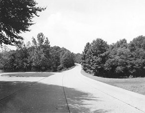
On our way between Yorktown and Jamestown we passed by Williamsburg on the Colonial Parkway.  This road actually connects the two National Park sites as part of the Colonial National Historical Park:

The Colonial Parkway is a twenty-three mile scenic roadway stretching from the York River at Yorktown to the James River at Jamestown. It connects Virginia's historic triangle: Jamestown, Williamsburg, and Yorktown. Several million travelers a year use this route to enjoy the natural and cultural beauty of Virginia.
Free of any "modern" commercial development, the parkway was designed to provide continuity to the visitor experience of motoring through nearly 400 years of American colonial history. Traversing a diverse environment, the parkway provides visitors with dramatic open vistas of rivers and tidal estuaries as well as shady passageways through pine and hardwood forests.

It was a nice drive, though a bit strange without lane markings.  But it was nice to drive without seeing signs of modern development along most of the route.  Sadly we didn't have the time (nor my wife the patience) to stop and photograph all of the sights and signs at the route's innumerable turnoffs, but I did photograph a few.

Origin of the York River
Cheatham Annex:

Confusing Bacons

All the pictures are in this album.
~Matt

Thursday, November 17, 2011

Battle of Yorktown

On Saturday Amy and I headed east on I-64.  For veterans day weekend all National Parks that normally charge admission were free to enter.  Incidentally I think it is a wonderful program.  The National Park system in this country is amazing, and I don't really begrudge them entrance fees (it should mean lower taxes, ;-)), but encouraging people to visit with free days is a wonderful idea.  I think it will encourage many local people to visit parks they might otherwise normally ignore due to their closeness.

We started off the day at the Yorktown Battlefield.  It had been many years since I'd been to a battlefield, and all those I've been to were from the Civil War (or as those who grew up in my wife's state might say, the War of Northern Aggression, ;-)).  I was quite eager to explore the battlefield, and we ended up spending more time there than Amy thought we would.  We started out with a tour through the visitor's center and its exhibits.  They have several artifacts from Washington's campaign tent and a 1/4 scale replica of part the HMS Charon, one of Cornwallis' ships that was sunk during the battle.

We bought an indispensable guide before we started out on the driving tour:
An audio tour of the 7-mile Battlefield Auto Tour Road is available for purchase in the sales shop. The cost of the audio tour is $4.95 for CD. It takes one hour and 15 minutes to complete.
If you're going to Yorktown then this is definitely worth the investment.  It was informative and filled in much information about each stop on the tour (despite a few annoying "come to a complete stop at the stop sign" instructions).  It also let you know every turn that you needed to take along the route.  Along with this, the map, and the signs (left) it would have been quite difficult to get lost.

We started out learning about the first allied siege lines, which were started under cover of rain clouds--which also made the digging much easier.
The "Grand French Battery" stood at one end of the line and ended up being one of the chief sources of the shells that pounded the British over the ensuing siege.

Soon after these first lines were established the troops started working on getting more trenches dug and earthworks erected even closer to the British Lines.
One of the crucial steps involved in setting up this second set of defenses were the taking of two outlying British fortifications, redoubts 9 and 10.  One was taken by a group of 400 crack French troops and the other by 400 veteran Americans.


The tour next took us into the woods where we saw the former location of the American supply depot, the Deposit.

Terrain was a key component of the battle.

I thought it was fascinating that this pond was in existence when the battle was fought:
We next took a slight detour (not from the tour, but from the fairly direct path up to this point) to drive to the Moore House.  This was where the surrender negotiations took place.  Apparently it is open some of the time, but wasn't the day we visited.  The Americans insisted on rather strict terms, that the British weren't allowed full military honors.  This was largely in retaliation for an American surrender earlier in the year at Charleston where they weren't accorded full honors by the British.
The fall scenery was really beautiful along the route.

And I enjoyed the plethora of signs, :-).
Though the visitor's center does provide a nice brochure, and we had the audio tour, I think we would have gotten a good amount of information even if we had only read the signs.

Over the course of the day we learned about how the fortifications were constructed, using wooden supports of various types to keep the earthenworks in position.  I imagine that it must have been difficult to move each gun into position, especially those siege guns that weren't on wheeled carriages.

As the sign at the left indicates, "Washington described in his diary the work done behind the scenes prior to the construction fo the First Allied Siege Line: 'Much diligence was used in debarking and transporting the Stores, Cannon, & Ca. from Trebells Landing (distant 6 Miles) on James River.  To camp; which for want of Teams went on heavily and in preparing Fascines, GAbions & ca. for the Siege...' "

Surrender Field was the last stop.  We could have continued onto a wider tour of the allied fortifications, but while some sources indicated there was an audio tour for this section, I never saw it.  We also knew that we wanted to see the rest of Jamestowne and a bit of Williamsburg before the end of the day.  Therefore it seemed as though this was the best place to end the tour before we drove off.  There was a a structure overlooking the field, where we could push a button to listen to a narration that explained about that day so many years ago.


Here is a video of the end of that narration and some views of the field itself:


~Matt